Океанская ГеоТЭС. Океанская геотэсОкеанская ГеоТЭС Вики
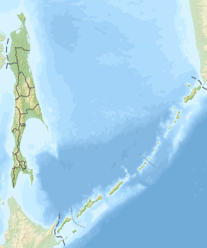
Океанская ГеоТЭС — геотермальная электростанция, расположенная у подножия вулкана Баранского на острове Итуруп в Сахалинской области. Название этой электростанции связано с непосредственной близостью к Тихому океану. История строительства[ | код]Развитие источников нетрадиционной энергетики на Курильских островах и освоение геотермальных источников — одно из направлений федеральной целевой программы «Социально-экономическое развитие Курильских островов (Сахалинская область) на 2007—2015 годы»[1], утверждённой Постановлением Правительства РФ от 9 августа 2006 г. № 478. В Постановлении сказано: На острове Итуруп разведаны и утверждены запасы пароводяной смеси в объеме 29,9 кгс. Этого количества достаточно для обеспечения электроснабжения г. Курильска. Необходимо осуществить строительство энергетического комплекса «Океанский» на геотермальном месторождении участка Кипящий (21 километр от г. Курильска). Введение объекта в эксплуатацию позволит сэкономить в год около 4 тыс. тонн дизельного топлива (60 млн рублей), себестоимость электроэнергии снизится в 3 раза, повысится качество и надежность электроснабжения. — Постановление Правительства РФ от 9 августа 2006 г. № 478 Заказчик-застройщик — Дирекция программы «Курилы», генпроектировщик — ОАО «Новосибирсктеплоэлектропроект», генподрядчик — ООО «Электросахмонтаж».
По имеющейся информации в 2007 г. станция введена в эксплуатацию с мощностью 2,5 МВт. Удельные капвложения в первую очередь станции оцениваются в 1 500 $/кВт со сроком окупаемости 8 лет.[2] Авария в 2013 году[ | код]27 февраля на ГеоТЭС «Океанская» произошла авария.[3] Из-за короткого замыкания и скачка напряжения отключилась подстанция. Нагрузка упала и турбогенераторы разогнались до оборотов, не предусмотренных параметрами этих агрегатов. В результате из строя вышел один энергомодуль. Второй был запущен 4 марта на неполную мощность. После аварии населенные пункты были переключены на 4 дизельные электростанции с. Китовое.[4] Вывод из эксплуатации[ | код]"Океанская ГеоТЭС" после череды аварий и ее неремонтопригодности в ноябре 2015 года была законсервирована. С ноября 2015 года выработка электроэнергии осуществляется только на ДЭС с. Китовый и ДЭС с. Рейдово (связаны в общий энергоузел ЛЭП 6 - 35 кВ с 2014 года).[5] Примечания[ | код]ru.wikibedia.ru Океанская ГеоТЭС - WikiVisually1. Россия – Russia, also officially the Russian Federation, is a country in Eurasia. The European western part of the country is more populated and urbanised than the eastern. Russias capital Moscow is one of the largest cities in the world, other urban centers include Saint Petersburg, Novosibirsk, Yekaterinburg, Nizhny Novgorod. Extending across the entirety of Northern Asia and much of Eastern Europe, Russia spans eleven time zones and incorporates a range of environments. It shares maritime borders with Japan by the Sea of Okhotsk, the East Slavs emerged as a recognizable group in Europe between the 3rd and 8th centuries AD. Founded and ruled by a Varangian warrior elite and their descendants, in 988 it adopted Orthodox Christianity from the Byzantine Empire, beginning the synthesis of Byzantine and Slavic cultures that defined Russian culture for the next millennium. Rus ultimately disintegrated into a number of states, most of the Rus lands were overrun by the Mongol invasion. The Soviet Union played a role in the Allied victory in World War II. The Soviet era saw some of the most significant technological achievements of the 20th century, including the worlds first human-made satellite and the launching of the first humans in space. By the end of 1990, the Soviet Union had the second largest economy, largest standing military in the world. It is governed as a federal semi-presidential republic, the Russian economy ranks as the twelfth largest by nominal GDP and sixth largest by purchasing power parity in 2015. Russias extensive mineral and energy resources are the largest such reserves in the world, making it one of the producers of oil. The country is one of the five recognized nuclear weapons states and possesses the largest stockpile of weapons of mass destruction, Russia is a great power as well as a regional power and has been characterised as a potential superpower. The name Russia is derived from Rus, a state populated mostly by the East Slavs. However, this name became more prominent in the later history, and the country typically was called by its inhabitants Русская Земля. In order to distinguish this state from other states derived from it, it is denoted as Kievan Rus by modern historiography, an old Latin version of the name Rus was Ruthenia, mostly applied to the western and southern regions of Rus that were adjacent to Catholic Europe. The current name of the country, Россия, comes from the Byzantine Greek designation of the Kievan Rus, the standard way to refer to citizens of Russia is Russians in English and rossiyane in Russian. There are two Russian words which are translated into English as Russians 2. Сахалинская область – Sakhalin Oblast is a federal subject of Russia comprising the island of Sakhalin and the Kuril Islands in Russias far east. The oblast has an area of 87,100 square kilometers and its administrative center and the largest city is Yuzhno-Sakhalinsk. Besides people from parts of the former Soviet Union and the Korean Peninsula. Sakhalin is rich in gas and oil, and is Russias second wealthiest federal subject. It is estimated that the proportion of ethnicities in this group is the same as that of the declared group, according to a 2012 official survey 21. In addition, 37% of the population declares to be spiritual but not religious, 15% is atheist, the indigenous people of Sakhalin are the Nivkhs, Oroki, and Ainu minorities. Early maps of Sakhalin reflect the uncertainty of the age as to whether or not the mass was attached to the Asian continent. The fact that it is not connected was conclusively established by Mamiya Rinzō, Japanese settlement on Sakhalin dates to at least the Edo period. Ōtomari was supposedly established in 1679, and cartographers of the Matsumae domain mapped the island, during the Ming and Qing dynasties China considered the island part of its empire, and included the Sakhalin peoples in its system for subjugated peoples. At no time though was any attempt made to establish an Imperial military presence on the island. Japan, concerned about Russian expansion in northeast Asia, unilaterally proclaimed sovereignty over the island in 1845. Russian settlers ignored this claim however, and beginning in the 1850s, established coal mines, administration facilities, schools, prisons, Russia also agreed to dismantle its military base at Ōtomari. South Sakhalin was administrated by Japan as Karafuto-chō, with the capital Toyohara, after the Russian Revolution and subsequent civil war northern Sakhalin ultimately became governed by the Russian SFSR as a part of Far Eastern Oblast, Far Eastern Krai and Khabarovsk Krai. Sakhalin Oblast was established on 20 October 1932 as a part of Far Eastern Krai, in August 1945, the Soviet Union took over the control of entire Sakhalin and Kuril Islands. The Soviet attack on South Sakhalin started on August 11,1945, the 56th Rifle Corps consisting of the 79th Rifle Division, the 2nd Rifle Brigade, the 5th Rifle Brigade and the 214th Tank Brigade attacked the Japanese 88th Division. Although the Red Army outnumbered the Japanese by three times, they could not advance due to strong Japanese resistance, Japanese resistance grew weaker after this landing. Actual fighting continued until August 21, however, this was relatively limited in scope. From August 22 to August 23, most of the remaining Japanese units announced truce, the Soviets completed the conquest of Sakhalin on August 25,1945 by occupying the capital of Sakhalin, then known as Toyohara 3. Геотермальная электростанция – Geothermal power is power generated by geothermal energy. Technologies in use include dry steam power stations, flash steam power stations, Geothermal electricity generation is currently used in 24 countries, while geothermal heating is in use in 70 countries. As of 2015, worldwide geothermal power capacity amounts to 12.8 gigawatts, International markets grew at an average annual rate of 5 percent over the last three years and global geothermal power capacity is expected to reach 14. 5–17.6 GW by 2020. Countries generating more than 15 percent of their electricity from geothermal sources include El Salvador, Kenya, Geothermal power is considered to be a sustainable, renewable source of energy because the heat extraction is small compared with the Earths heat content. In the 20th century, demand for electricity led to the consideration of geothermal power as a generating source, prince Piero Ginori Conti tested the first geothermal power generator on 4 July 1904 in Larderello, Italy. It successfully lit four light bulbs, later, in 1911, the worlds first commercial geothermal power station was built there. Experimental generators were built in Beppu, Japan and the Geysers, California, in the 1920s, in 1958, New Zealand became the second major industrial producer of geothermal electricity when its Wairakei station was commissioned. Wairakei was the first station to use flash steam technology, in 1960, Pacific Gas and Electric began operation of the first successful geothermal electric power station in the United States at The Geysers in California. The original turbine lasted for more than 30 years and produced 11 MW net power, the binary cycle power station was first demonstrated in 1967 in Russia and later introduced to the USA in 1981, following the 1970s energy crisis and significant changes in regulatory policies. This technology allows the use of lower temperature resources than were previously recoverable. In 2006, a binary cycle station in Chena Hot Springs, Alaska, came on-line, Geothermal electric stations have until recently been built exclusively where high temperature geothermal resources are available near the surface. The development of binary cycle power plants and improvements in drilling, demonstration projects are operational in Landau-Pfalz, Germany, and Soultz-sous-Forêts, France, while an earlier effort in Basel, Switzerland was shut down after it triggered earthquakes. Other demonstration projects are under construction in Australia, the United Kingdom, the thermal efficiency of geothermal electric stations is low, around 7–10%, because geothermal fluids are at a low temperature compared with steam from boilers. By the laws of thermodynamics this low temperature limits the efficiency of engines in extracting useful energy during the generation of electricity. Exhaust heat is wasted, unless it can be used directly and locally, for example in greenhouses, timber mills, and district heating. The efficiency of the system does not affect operational costs as it would for a coal or other fossil fuel plant, in order to produce more energy than the pumps consume, electricity generation requires high temperature geothermal fields and specialized heat cycles. Because geothermal power does not rely on sources of energy, unlike, for example, wind or solar. However the global average capacity factor was 74. 5% in 2008, the earth’s heat content is about 1031 joules 4. Вулкан Баранского – Baransky is a stratovolcano located in the central part of Iturup Island, Kuril Islands, Russia. The volcano is named after Nikolay Baransky, Soviet economic geographer, list of volcanoes in Russia Baransky 5. Итуруп – Iturup is one of the Kuril Islands. It was formerly known as Staten Island and it is the largest and northernmost island in the southern Kurils, which are disputed between Japan and Russia. The island was Japanese territory until the end of the Second World War in 1945, the island is still claimed by Japan. Japan considers a site on Iturup to be its northernmost point, Iturup is located near the southern end of the Kuril chain, between Kunashiri and Urup. The town of Kurilsk, administrative center of Kurilsky District, is located midway along its western shore. Iturup consists of volcanic massifs and mountain ridges, a series of a dozen volcanoes running NE to SW form the backbone of the island, the highest being Stokap in the central part of Iturup. The shores of the island are high and abrupt, the vegetation mostly consists of spruce, larch, pine, fir, and mixed deciduous forests with alder, lianas and Kuril bamboo underbrush. The mountains are covered with birch and Siberian Dwarf Pine scrub, the island also contains some of high waterfalls, such as the Ilya Muromets. Rheniite, a sulfide mineral, was discovered at the Kudriavy volcano. It is found in active hot fumaroles on the volcano, initially inhabited by the Ainu, Iturup was reached in 1661 by the Japanese Shichirobei and his fellows after they had drifted there. The island saw both a Russian settlement and a Japanese garrison at the site of the present-day Kurilsk, in 1855 Iturup was ceded to Japan by the Treaty of Shimoda. Its name comes from the Ainu エツ゚ヲロプ, meaning Place possessing capes, on 26 November 1941, a Japanese carrier fleet left Hitokappu Bay, on the eastern shore of Iturup, and sailed for an attack on the American base of Pearl Harbor. In 1945, according to decisions of the Yalta Conference, it was occupied by the Soviet Union after Japans defeat in World War II, the Japanese inhabitants were expelled to mainland Japan. In 1956 the two agreed to restore diplomatic relations, but the peace treaty, as of 2016, has not been concluded due to the disputed status of Iturup. A Soviet Anti-Air Defense airfield, Burevestnik, is located on the island, in 1968, Seaboard World Airlines Flight 253A was intercepted over the Kurils and forced to land at Burevestnik with 214 American troops bound for Vietnam. An older airfield, Vetrovoe, exists on the part of the island. Administratively this island belongs to the Sakhalin Oblast of the Russian Federation, a new international airport, Iturup Airport, was opened on the island in September 2014. There are plans for a bandy match between Sakhalin and the Japanese national team on Iturup 6. Тихий океан – The Pacific Ocean is the largest and deepest of the Earths oceanic divisions. It extends from the Arctic Ocean in the north to the Southern Ocean in the south and is bounded by Asia and Australia in the west, the Mariana Trench in the western North Pacific is the deepest point in the world, reaching a depth of 10,911 metres. Both the center of the Water Hemisphere and the Western Hemisphere are in the Pacific Ocean, the oceans current name was coined by Portuguese explorer Ferdinand Magellan during the Spanish circumnavigation of the world in 1521, as he encountered favourable winds on reaching the ocean. He called it Mar Pacífico, which in both Portuguese and Spanish means peaceful sea, important human migrations occurred in the Pacific in prehistoric times. Long-distance trade developed all along the coast from Mozambique to Japan, trade, and therefore knowledge, extended to the Indonesian islands but apparently not Australia. By at least 878 when there was a significant Islamic settlement in Canton much of trade was controlled by Arabs or Muslims. In 219 BC Xu Fu sailed out into the Pacific searching for the elixir of immortality, from 1404 to 1433 Zheng He led expeditions into the Indian Ocean. The east side of the ocean was discovered by Spanish explorer Vasco Núñez de Balboa in 1513 after his expedition crossed the Isthmus of Panama and he named it Mar del Sur because the ocean was to the south of the coast of the isthmus where he first observed the Pacific. Later, Portuguese explorer Ferdinand Magellan sailed the Pacific East to West on a Castilian expedition of world circumnavigation starting in 1519, Magellan called the ocean Pacífico because, after sailing through the stormy seas off Cape Horn, the expedition found calm waters. The ocean was often called the Sea of Magellan in his honor until the eighteenth century, sailing around and east of the Moluccas, between 1525 and 1527, Portuguese expeditions discovered the Caroline Islands, the Aru Islands, and Papua New Guinea. In 1542–43 the Portuguese also reached Japan, in 1564, five Spanish ships consisting of 379 explorers crossed the ocean from Mexico led by Miguel López de Legazpi and sailed to the Philippines and Mariana Islands. The Manila galleons operated for two and a half centuries linking Manila and Acapulco, in one of the longest trade routes in history, Spanish expeditions also discovered Tuvalu, the Marquesas, the Cook Islands, the Solomon Islands, and the Admiralty Islands in the South Pacific. In the 16th and 17th century Spain considered the Pacific Ocean a Mare clausum—a sea closed to other naval powers, as the only known entrance from the Atlantic the Strait of Magellan was at times patrolled by fleets sent to prevent entrance of non-Spanish ships. On the western end of the Pacific Ocean the Dutch threatened the Spanish Philippines, Spain also sent expeditions to the Pacific Northwest reaching Vancouver Island in southern Canada, and Alaska. The French explored and settled Polynesia, and the British made three voyages with James Cook to the South Pacific and Australia, Hawaii, and the North American Pacific Northwest, one of the earliest voyages of scientific exploration was organized by Spain in the Malaspina Expedition of 1789–1794. It sailed vast areas of the Pacific, from Cape Horn to Alaska, Guam and the Philippines, New Zealand, Australia, and the South Pacific. Growing imperialism during the 19th century resulted in the occupation of much of Oceania by other European powers, and later, Japan, in Oceania, France got a leading position as imperial power after making Tahiti and New Caledonia protectorates in 1842 and 1853 respectively. After navy visits to Easter Island in 1875 and 1887, Chilean navy officer Policarpo Toro managed to negotiate an incorporation of the island into Chile with native Rapanui in 1888, by occupying Easter Island, Chile joined the imperial nations 7. Курильск – Kurilsk, Japanese, 紗那村, Shanamura) is a town and the administrative center of Kurilsky District of Sakhalin Oblast, Russia, located on the island of Iturup. Ainu have been known to inhabit the present site of Kurilsk since the 2nd millennium BCE, with their settlement known as Shana, Russian colonists first appeared on Iturup in the late 18th century, with the Japanese erecting a military post in 1800. Under Japanese administration that ended in 1945, the village of Shana was the settlement of the island. As of August 15,1945, the population of the village was 1,001, in 1947, the village was given its present name and granted town status by the Soviets. All Japanese villagers were exiled, however, the Japanese do not recognize it to have been legally dissolved, within the framework of administrative divisions, Kurilsk serves as the administrative center of Kurilsky District and is subordinated to it. As a municipal division, the town of Kurilsk and six rural localities of Kurilsky District are incorporated as Kurilsky Urban Okrug, Kurilsk is a center for fishing and fish farming, particularly salmon. A tsunami warning station is located in the town. Remarkably for its southerly latitude, Kurilsk has a subarctic climate owing to the powerful influence of the cold Oyashio Current which makes summers exceptionally cool. Unlike most subarctic climates, however, the winters are fairly mild, Закон №25-ЗО от23 марта2011 г. «Об административно-территориальном устройстве Сахалинской области», в ред, Закона №62-ЗО от27 июня2013 г. «О внесении изменения в статью10 Закона Сахалинской области Об административно-территориальном устройстве Сахалинской области», Вступил в силу9 апреля2011 г. Опубликован, Губернские ведомости, №55,29 марта2011 г, Закон №524 от21 июля2004 г. «О границах и статусе муниципальных образований в Сахалинской области», в ред, Закона №45-ЗО от27 мая2013 г. «О внесении изменения в Закон Сахалинской области О границах и статусе муниципальных образований в Сахалинской области», Вступил в силу1 января2005 г. Опубликован, Губернские ведомости, №175–176,31 июля2004 г 8. Электроэнергетика – Electricity became a subject of scientific interest in the late 17th century with the work of William Gilbert. Over the next two centuries a number of important discoveries were made including the incandescent light bulb and the voltaic pile, in 1881 two electricians built the worlds first power station at Godalming in England. The station employed two waterwheels to produce a current that was used to supply seven Siemens arc lamps at 250 volts. The Pearl Street Station consisted of several generators and initially powered around 3,000 lamps for 59 customers, the power station used direct current and operated at a single voltage. That same year in London Lucien Gaulard and John Dixon Gibbs demonstrated the first transformer suitable for use in a power system. Despite the success of the system, the pair made some fundamental mistakes, perhaps the most serious was connecting the primaries of the transformers in series so that switching one lamp on or off would affect other lamps further down the line. Using this knowledge he built the worlds first practical transformer based alternating current power system at Great Barrington, during this time a fierce rivalry in the US known as the War of Currents emerged between Edison and Westinghouse over which form of transmission was superior. In 1891, Westinghouse installed the first major power system that was designed to drive an electric motor, the installation powered a 100 horsepower synchronous motor at Telluride, Colorado with the motor being started by a Tesla induction motor. In 1895, after a protracted decision-making process, the Adams No.1 generating station at Niagara Falls began transmitting three-phase alternating current power to Buffalo at 11 kV. Following completion of the Niagara Falls project, new power systems increasingly chose alternating current as opposed to direct current for electrical transmission, although the 1880s and 1890s were seminal decades in the field, developments in power engineering continued throughout the 20th and 21st century. In 1936 the first commercial high-voltage direct current line using mercury-arc valves was built between Schenectady and Mechanicville, New York, HVDC had previously been achieved by installing direct current generators in series although this suffered from serious reliability issues. In 1957 Siemens demonstrated the first solid-state rectifier however it was not until the early 1970s that this technology was used in power systems. In 1959 Westinghouse demonstrated the first circuit breaker that used SF6 as the interrupting medium, SF6 is a far superior dielectric to air and, in recent times, its use has been extended to produce far more compact switching equipment and transformers. Many important developments also came from extending innovations in the ICT field to the engineering field. For example, the development of computers meant load flow studies could be run more efficiently allowing for better planning of power systems. Advances in information technology and telecommunication also allowed for much better control of the power systems switchgear. Electric power is the product of two quantities, current and voltage. These two quantities can vary with respect to time or can be kept at constant levels, most refrigerators, air conditioners, pumps and industrial machinery use AC power whereas computers and digital equipment use DC power wikivisually.com
www.turkaramamotoru.com Океанская ГеоТЭС - ВикиРазвитие источников нетрадиционной энергетики на Курильских островах и освоение геотермальных источников — одно из направлений федеральной целевой программы «Социально-экономическое развитие Курильских островов (Сахалинская область) на 2007—2015 годы»[1], утверждённой Постановлением Правительства РФ от 9 августа 2006 г. № 478. В Постановлении сказано: На острове Итуруп разведаны и утверждены запасы пароводяной смеси в объеме 29,9 кгс. Этого количества достаточно для обеспечения электроснабжения г. Курильска. Необходимо осуществить строительство энергетического комплекса «Океанский» на геотермальном месторождении участка Кипящий (21 километр от г. Курильска). Введение объекта в эксплуатацию позволит сэкономить в год около 4 тыс. тонн дизельного топлива (60 млн рублей), себестоимость электроэнергии снизится в 3 раза, повысится качество и надежность электроснабжения. — Постановление Правительства РФ от 9 августа 2006 г. № 478 Заказчик-застройщик — Дирекция программы «Курилы», генпроектировщик — ОАО «Новосибирсктеплоэлектропроект», генподрядчик — ООО «Электросахмонтаж».
По имеющейся информации в 2007 г. станция введена в эксплуатацию с мощностью 2,5 МВт. Удельные капвложения в первую очередь станции оцениваются в 1 500 $/кВт со сроком окупаемости 8 лет.[2] 27 февраля на ГеоТЭС «Океанская» произошла авария.[3] Из-за короткого замыкания и скачка напряжения отключилась подстанция. Нагрузка упала и турбогенераторы разогнались до оборотов, не предусмотренных параметрами этих агрегатов. В результате из строя вышел один энергомодуль. Второй был запущен 4 марта на неполную мощность. После аварии населенные пункты были переключены на 4 дизельные электростанции с. Китовое.[4] ru.wikiredia.com Океанская ГеоТЭС - ВикипедияМатериал из Википедии — свободной энциклопедии Текущая версия страницы пока не проверялась опытными участниками и может значительно отличаться от версии, проверенной 26 ноября 2014; проверки требуют 5 правок. Текущая версия страницы пока не проверялась опытными участниками и может значительно отличаться от версии, проверенной 26 ноября 2014; проверки требуют 5 правок.
Океанская ГеоТЭС — геотермальная электростанция, расположенная у подножия вулкана Баранского на острове Итуруп в Сахалинской области. Название этой электростанции связано с непосредственной близостью к Тихому океану. История строительства[ | ]Развитие источников нетрадиционной энергетики на Курильских островах и освоение геотермальных источников — одно из направлений федеральной целевой программы «Социально-экономическое развитие Курильских островов (Сахалинская область) на 2007—2015 годы»[1], утверждённой Постановлением Правительства РФ от 9 августа 2006 г. № 478. В Постановлении сказано: На острове Итуруп разведаны и утверждены запасы пароводяной смеси в объеме 29,9 кгс. Этого количества достаточно для обеспечения электроснабжения г. Курильска. Необходимо осуществить строительство энергетического комплекса «Океанский» на геотермальном месторождении участка Кипящий (21 километр от г. Курильска). Введение объекта в эксплуатацию позволит сэкономить в год около 4 тыс. тонн дизельного топлива (60 млн рублей), себестоимость электроэнергии снизится в 3 раза, повысится качество и надежность электроснабжения.— Постановление Правительства РФ от 9 августа 2006 г. № 478 Заказчик-застройщик — Дирекция программы «Курилы», генпроектировщик — ОАО «Новосибирсктеплоэлектропроект», генподрядчик — ООО «Электросахмонтаж».
По имеющейся информации в 2007 г. станция введена в эксплуатацию с мощностью 2,5 МВт. Удельные капвложения в первую очередь станции оцениваются в 1 500 $/кВт со сроком окупаемости 8 лет.[2] Авария в 2013 году[ | ]27 февраля на ГеоТЭС «Океанская» произошла авария.[3] Из-за короткого замыкания и скачка напряжения отключилась подстанция. Нагрузка упала и турбогенераторы разогнались до оборотов, не предусмотренных параметрами этих агрегатов. В результате из строя вышел один энергомодуль. Второй был запущен 4 марта на неполную мощность. После аварии населенные пункты были переключены на 4 дизельные электростанции с. Китовое.[4] Примечания[ | ]encyclopaedia.bid Океанская ГеоТЭС — ВикипедияРазвитие источников нетрадиционной энергетики на Курильских островах и освоение геотермальных источников — одно из направлений федеральной целевой программы «Социально-экономическое развитие Курильских островов (Сахалинская область) на 2007—2015 годы»[1], утверждённой Постановлением Правительства РФ от 9 августа 2006 г. № 478. В Постановлении сказано: На острове Итуруп разведаны и утверждены запасы пароводяной смеси в объеме 29,9 кгс. Этого количества достаточно для обеспечения электроснабжения г. Курильска. Необходимо осуществить строительство энергетического комплекса «Океанский» на геотермальном месторождении участка Кипящий (21 километр от г. Курильска). Введение объекта в эксплуатацию позволит сэкономить в год около 4 тыс. тонн дизельного топлива (60 млн рублей), себестоимость электроэнергии снизится в 3 раза, повысится качество и надежность электроснабжения. — Постановление Правительства РФ от 9 августа 2006 г. № 478 Заказчик-застройщик — Дирекция программы «Курилы», генпроектировщик — ОАО «Новосибирсктеплоэлектропроект», генподрядчик — ООО «Электросахмонтаж».
По имеющейся информации в 2007 г. станция введена в эксплуатацию с мощностью 2,5 МВт. Удельные капвложения в первую очередь станции оцениваются в 1 500 $/кВт со сроком окупаемости 8 лет.[2] 27 февраля на ГеоТЭС «Океанская» произошла авария.[3] Из-за короткого замыкания и скачка напряжения отключилась подстанция. Нагрузка упала и турбогенераторы разогнались до оборотов, не предусмотренных параметрами этих агрегатов. В результате из строя вышел один энергомодуль. Второй был запущен 4 марта на неполную мощность. После аварии населенные пункты были переключены на 4 дизельные электростанции с. Китовое.[4] pywb-hypothesis.herokuapp.com Океанская ГеоТЭС - Gpedia, Your EncyclopediaТекущая версия страницы пока не проверялась опытными участниками и может значительно отличаться от версии, проверенной 26 ноября 2014; проверки требуют 7 правок.
Океанская ГеоТЭС — геотермальная электростанция, расположенная у подножия вулкана Баранского на острове Итуруп в Сахалинской области. Название этой электростанции связано с непосредственной близостью к Тихому океану. История строительстваРазвитие источников нетрадиционной энергетики на Курильских островах и освоение геотермальных источников — одно из направлений федеральной целевой программы «Социально-экономическое развитие Курильских островов (Сахалинская область) на 2007—2015 годы»[1], утверждённой Постановлением Правительства РФ от 9 августа 2006 г. № 478. В Постановлении сказано: На острове Итуруп разведаны и утверждены запасы пароводяной смеси в объеме 29,9 кгс. Этого количества достаточно для обеспечения электроснабжения г. Курильска. Необходимо осуществить строительство энергетического комплекса «Океанский» на геотермальном месторождении участка Кипящий (21 километр от г. Курильска). Введение объекта в эксплуатацию позволит сэкономить в год около 4 тыс. тонн дизельного топлива (60 млн рублей), себестоимость электроэнергии снизится в 3 раза, повысится качество и надежность электроснабжения. — Постановление Правительства РФ от 9 августа 2006 г. № 478 Заказчик-застройщик — Дирекция программы «Курилы», генпроектировщик — ОАО «Новосибирсктеплоэлектропроект», генподрядчик — ООО «Электросахмонтаж».
По имеющейся информации в 2007 г. станция введена в эксплуатацию с мощностью 2,5 МВт. Удельные капвложения в первую очередь станции оцениваются в 1 500 $/кВт со сроком окупаемости 8 лет.[2] Авария в 2013 году27 февраля на ГеоТЭС «Океанская» произошла авария.[3] Из-за короткого замыкания и скачка напряжения отключилась подстанция. Нагрузка упала и турбогенераторы разогнались до оборотов, не предусмотренных параметрами этих агрегатов. В результате из строя вышел один энергомодуль. Второй был запущен 4 марта на неполную мощность. После аварии населенные пункты были переключены на 4 дизельные электростанции с. Китовое.[4] Вывод из эксплуатации"Океанская ГеоТЭС" после череды аварий и ее неремонтопригодности в ноябре 2015 года была законсервирована. С ноября 2015 года выработка электроэнергии осуществляется только на ДЭС с. Китовый и ДЭС с. Рейдово (связаны в общий энергоузел ЛЭП 6 - 35 кВ с 2014 года).[5] Примечанияwww.gpedia.com | |||||||||||||||||||||||||||||||||
|
|||||||||||||||||
|
|
|||||||||||||||||
|
 Океанская ГеоТЭСОкеанская ГеоТЭС
  Россия
 Сахалинская область